Official DILG-Cordillera Administrative Region Facebook updates are shown below, with the DILG-CAR website checked as a secondary source. These are DILG notices for awareness and do not become Calanasan municipal orders unless separately adopted and published by an authorized local official.
Loading official DILG-CAR advisories...
Official Facebook timelineDILG-Cordillera Administrative Region
Official public updates from the Office of Civil Defense Cordillera Administrative Region are displayed separately for regional situational awareness. These notices do not become Calanasan municipal orders unless separately adopted and published by an authorized local official.
If Facebook blocks the embedded timeline or asks you to sign in, use “Open on Facebook” to review the official page directly.
Operations mode24/7 Monitoring
For authorized duty officers
OPERATIONAL STATUS: NORMALLast updated: 2 mins ago
0 Active Alerts
📊 Situation Overview
LIVE EOC BOARD
Preparing verified feedsDashboard not updated yet
Next refresh: 05:00
🌧
Rainfall Monitor
PAGASA
Live
12.5mm
↑ 2.3last 3hrs
0mm50mm
🌡
Barangay Heat Index
Local Sensors
Live
32°C
→ 0.5last 1hr
CautionExtreme
🌋
Seismic Activity
PHIVOLCS
Live
Pendingmag
Awaiting feedPHIVOLCS
157
🔥
Fire Detection
NASA FIRMS
2 hrs
0spots
24h: 07d: 2
LowExtreme
🚑
Active Incidents
MDRRMO
PENDING
—active
Ongoing—
Validation—
✓ Responded⏱ Monitoring
MUNICIPAL ASSESSMENT
Current Operational Risk
NORMAL
Verified monitoring data is being consolidated.
Waiting for live portal readings…
WHAT CHANGED
Since Previous Update
The next verified update will show changes here.
OPERATIONAL COORDINATION
Coordination and Escalation Matrix
Preparing assignments
Preparing current coordination assignments.
🔷 Situational Overview
Domain-specific monitoring and response systems
🌧
LIVE
Hydrometeorological
Weather & Water Systems
PAGASA APIReal-time
Loading24h Rain
LoadingRiver Level
LoadingHumidity
All Systems Normal
🌡
MONITOR
Heat Health System
Temperature & Public Safety
Local Sensors5 min
LoadingHeat Index
LoadingMax Temp
CautionRisk Level
Caution Level - Monitor Sensitive Groups
🌋
ACTIVE
Geological Hazards
Seismic & Ground Stability
PHIVOLCSReal-time
PendingLatest Mag
PendingSince Event
LowLandslide Risk
Monitoring Recent Activity
🔥
SCAN
Fire Detection System
Wildfire & Hotspot Monitoring
NASA FIRMS2 hrs
0Active Spots
27-Day Total
LowFire Danger
No Active Fire Threats Detected
🚑
RESPOND
Incident Response
Emergency Operations Center
MDRRMOLive
2Active
5Responding
1224h Total
2 Incidents - Response Teams Deployed
🔷 Analytics & Monitoring
Risk profiling, workflow monitoring, and visual hazard mapping
Collecting public advisories, MDRRMO updates, and live monitoring status.
Source: Public advisory/news stores and live monitoring status loading...
📈
Incidents by Status
Workflow monitoring
0
Validation
0
Ongoing
0
Resolved
Source: Incident store loading...
🗺
Quick Map View
Visual hazard mapping
Interactive hazard map
🎛
Adaptive Theme Panel
Changes UI based on hazard level
Normal
Rain
Heat
Geo
Fire
Normal OperationsEmergency Operations Center is ready for routine coordination and monitoring.No Rainfall WarningMunicipal rainfall watch is clear based on current local monitoring. Current municipal rainfall: 0.0 mm/hr.No Active PAGASA AlertLatest PAGASA bulletin check shows no active public weather alert.
Emergency Operations Center Dashboard
Centralized monitoring, response coordination, and public information for Calanasan MDRRMO.
This dashboard is your quick situation snapshot before entering each operational layer.
🛰 Monitoring Ready🚑 Response Support👥 Public Services🌍 Geological Hazard Monitoring
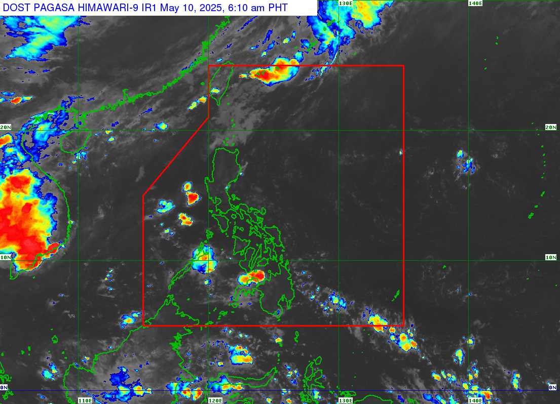
Source hierarchy: PAGASA is the official Philippine warning authority. JMA RSMC Tokyo is a secondary technical reference for tropical cyclone position, movement, intensity, and forecasts across the western North Pacific and South China Sea.
TCWS No.Checking current PAGASA TCWS...
IntensityNot specified
MovementNot specified
IssuedLatest parsed update
Source basis: Waiting for parsed PAGASA source.
Source: Waiting for the latest cyclone update
📝 Update PAGASA Summary (MDRRMO)
No active tropical cyclone is currently confirmed by PAGASA.
——————
Civil Defense Cordillera Facebook Updates
Feed SummaryOCD-CAR regional public safety watch
Review the latest post text for Cordillera preparedness notices, weather forecast cards, response coordination updates, and public advisory reminders. Cross-check any weather-related item with PAGASA before issuing local Calanasan guidance.
No active tropical cyclone alert or rainfall warning is affecting Calanasan at this time.
Cyclone SignalMonitoring / Unconfirmed
Rainfall Coverage0 / 20 barangays
Local Rain AdvisoryNo rainfall detected
Recommended ActionContinue routine monitoring and keep PAGASA and barangay rainfall checks active.
Duty Officer Decision Checklist
Decision OutputNo advisory needed
Routine monitoring is sufficient while PAGASA and rainfall indicators remain clear.
Next Duty StepContinue source monitoring and update this checklist if conditions change.
Coordination ReminderLog any advisory decision with time, source, and officer name before public release.
🚦 Travel Route Forecast
Route Status:All routes clear
Next 24 Hours:No significant rain expected on main travel corridors
Risk Level:LOW
Source: Barangay and adjacent municipality rainfall monitoring tables. Refreshes from live weather feeds when available.
📢 Latest MDRRMO Weather Advisory
🌦 Rain Presence (Observed)
☁ No rainfall detected
Checking barangay rainfall coverage...
✅ No rainfall warning
Weather advisory is initializing from rainfall and PAGASA cyclone monitoring.
Continue routine monitoring while live sources update.
Community Guidance
Expected Impacts
🚙Travel
No immediate weather-related travel disruption expected.
🌊Waterways
Normal conditions expected; continue routine observation.
⛰️Slopes and outdoors
No elevated weather impact identified from current verified data.
Community Action LevelNORMALRoutine monitoring
NORMAL Routine monitoringMONITOR Increase observationPREPARE Ready personnel and equipmentACT Follow authorized evacuation or access restrictions
What this means: This level summarizes the MDRRMO's recommended readiness for the community. It does not replace PAGASA warning levels. “ACT” does not automatically order evacuation or road closure; follow instructions issued by the Mayor, MDRRMC, MDRRMO, barangay officials, or another legally authorized authority.
Municipal Rainfall Rate:
0.0 mm/hr
Light or intermittent rain may occur even when rainfall rate is shown as
0.0 mm/hr. Rainfall warnings are based on measurable
accumulation and flood risk thresholds.
🌡 Temperature:
22.6 °C
|
💨 Wind Speed:
0.9 m/s
Last Updated: Apr 10, 2026, 1:13 AM
Rainfall rate derived from OpenWeatherMap. Official warnings remain with PAGASA.
Recent public posts from the official DOST-PAGASA Facebook page. This can surface tropical depression or outside-PAR updates that may appear on Facebook before a matching bulletin is posted on the main PAGASA weather feed.
The embedded timeline runs Meta’s own scripts; red console lines mentioning facebook.com or missing element IDs come from that plugin, not from this portal’s cyclone text scanner.
Reliability note: provider values are coordinate-based weather estimates, not barangay rain-gauge measurements. Only a current on-site report is shown as field-confirmed. Feeds older than three hours are rejected. Official warnings remain with PAGASA.
📊 5-Day Weather Outlook
LOW RAINFALL RISK
ReasonForecast model is still loading.
MDRRMO ActionMaintain routine monitoring until the forecast is analyzed.
Source & ConfidenceOpenWeatherMap forecast point for Calanasan. Validate warnings with PAGASA.
Thu
☀️
23°C
LOW RISK
🌧 0.0 mm
Fri
☀️
27°C
LOW RISK
🌧 0.0 mm
Sat
☀️
27°C
LOW RISK
🌧 0.0 mm
Sun
☀️
28°C
LOW RISK
🌧 0.0 mm
Mon
☀️
27°C
LOW RISK
🌧 0.0 mm
📍 Barangay Risk Status (Rainfall Context)
Santa Filomena
Santa Elena
Macalino
Cadaclan
Eva Puzon
Tanglagan
Parina
Bucarot
Eleazar
Sabangan
Don Roque Ablan Sr.
Naguilian
Poblacion
Ferdinand
Ninoy Aquino
Kabugawan
Langnao
Namaltugan
Tubongan
Butao
Local Automatic Weather Station
LIGTAS-AGAD Calanasan AWS
Ground observations from the municipal automatic weather station at 18.24502° N, 121.04929° E.
Checking the latest published AWS observation…
TemperatureChecking…
Relative HumidityChecking…
Current RainfallChecking…
7-Day RainfallChecking…
Dew PointChecking…
Water ContentChecking…
Station BatteryChecking…
Latest Station TransmissionChecking…
Source recognition: LIGTAS-AGAD Calanasan Automatic Weather Station. Local observations support situational awareness; official weather warnings remain with DOST-PAGASA.
Hydrometeorological instruments
WLMS / ARG Monitoring
Current water-level and automatic rain-gauge information supporting the rainfall risk context above.
Checking official station sources...
Current Sources0
Rainfall ContextChecking...
Calanasan Water LevelChecking...
Latest UpdateChecking...
Station / Source
Instrument
Reading
Updated
Status
Checking official WLMS/ARG sources...
Only current verified observations are counted as live. Historical or offline Calanasan sensors remain clearly labeled and are never presented as current readings.
Data integrity: PAGASA ground observations, PAGASA basin bulletins, model estimates, and offline Calanasan instruments are labeled separately. Estimated rainfall is never presented as an ARG reading, and no numerical Calanasan water level is shown without a current gauge transmission.
👥 Citizen Incident Reporting
Community Reporting Channel
Report local conditions or an incident.
Share a weather observation or emergency report through one guided, secure workflow for MDRRMO review.
WorkflowGuide → ReportRequired details are validated
Help improve local awareness
What is the weather like where you are?
Your field observation can help MDRRMO compare automated readings with actual barangay conditions. Reports are reviewed before operational use.
Interactive Incident Guide
Select the emergency type first so citizens know what details to prepare before opening the official report form.
Local Weather ConditionReport what you can personally observe: rain intensity, strong wind, visibility, rising water, exact barangay or sitio, and the time observed. Community reports are reviewed before operational use.
Portal Report Form
Report a local condition or incident directly to the MDRRMO portal.
Saved in the MDRRMO reporting systemYour submission is recorded for MDRRMO validation and inclusion in the shared Incident Log. This form stays inside the portal.
ICS Forms Library
Incident Command System
Official Attached ICS Form Set
Search, filter, open, fill, print, and download only the attached ICS Word templates approved for this portal section.
0forms shown
No ICS forms match the current search or category filter.
Fill Online
ICS Form
📒 OPCEN Daily Incident Log
Operations Center Record
Incident Log & Response Tracking
Locate reports, review field information, and follow operational status from validation through resolution.
Record statusLive MonitoringShared MDRRMO incident store
📊
Verified Operations
Incident Monitoring Control
Active Log
Track reported incidents, open photo evidence, and update responder status in one place.
Date & Time
Barangay
Incident
Status
Action
No incident has been reported at this time.
✓
Awaiting Officer Review
Incident Review Queue
Unverified
Invalid, suspicious, duplicate-risk, or incomplete citizen reports are held here for MDRRMO review instead of being injected into the active monitoring list.
No reports waiting for review
Queued citizen submissions that need officer validation will appear here.
📄 Incident Report (Authorized Personnel Only)
🚑 Responder Dispatch Panel
No dispatch assignments yetAssign a responder team to start the operational dispatch board.
🧺 Relief Stockpile Snapshot
Quick view of current food and non-food inventory for dispatch, relief planning, and replenishment monitoring.
5. Barangay Coordination Barangays with coordination record: 0
6. Weather / Trigger Normal monitoring posture. Weather-linked operations support remains on standby.
🌦 Weather-to-Operations Trigger
Normal monitoring posture. Weather-linked operations support remains on standby.
Continue routine patrol and verification of reported incidents.
Keep communications and dispatch logs updated every operational period.
🆘 Public Emergency Quick Help
Quick Service Selector
Select the service you need most and the panel will show the best contact and next action.
MDRRMO / RescueRecommended hotline: 0997-763-2050 Call MDRRMO first for rescue coordination, flooding, landslide, evacuation, and general emergency reporting.
Family Go-Bag Readiness
Use this simple checklist before heavy rain, evacuation, or prolonged power interruption.
Go-bag readiness: 0 / 4 complete
📲 Best LGU Contact Flow
Use the fastest contact channel first during emergencies, then follow with message or formal reporting when needed.
🔴 Emergency
☎ Hotline
For rescue, evacuation, flooding, landslide, and urgent response, call the MDRRMO hotline first.
Public School ShelterPoblacion • 180 persons • Standby
RHU Temporary ShelterPoblacion • 60 persons • Medical Support
Before leaving for evacuation:
Bring your go-bag, medicines, drinking water, and keep your family grouped together. Wait for MDRRMO or barangay instruction before transferring.
Wait for MDRRMO or barangay instructions before transferring to an evacuation site.
Public Preparedness Library
Information, Education & Communication Materials
Practical, downloadable safety guides for households, schools, barangays, and community responders.
Open a guide to review key actions, then download a copy for offline reference or community distribution.
🌪
Typhoon PreparednessIEC Material
Monitor official advisories, secure roofs and light materials, charge phones, prepare go-bags, and move early if your barangay is advised to evacuate.
Track official advisories
Secure loose materials
Evacuate early when advised
🌍
Earthquake SafetyIEC Material
During shaking: Drop, Cover, and Hold On. After shaking, move to an open area, expect aftershocks, and check family members for injuries.
Drop, Cover, Hold On
Expect aftershocks
Check injuries after shaking
🌊
Flood PreparednessIEC Material
Avoid crossing flooded roads and rivers, move appliances and documents higher, and evacuate early when floodwaters rise quickly or at night.
Do not cross floodwater
Move valuables higher
Leave early as water rises
⛰
Landslide Warning SignsIEC Material
Watch for cracks on the ground, tilting trees, rumbling sounds, and sudden muddy water flow. Leave slope-side houses immediately when signs appear.
Watch for cracks and rumbling
Leave slope-side homes early
Report blocked roads immediately
🎒
Go-Bag EssentialsIEC Material
Prepare water, ready-to-eat food, flashlight, radio, batteries, medicines, hygiene kit, IDs, important documents, and emergency cash.
Pack food and water
Include IDs and medicine
Keep it near the exit
🔥
Heat and Fire SafetyIEC Material
Limit outdoor activity during extreme heat, drink water often, avoid open burning, check electrical connections, and report smoke or fire immediately.
Hydrate often
Avoid open burning
Check electrical safety
⚡
Lightning SafetyIEC Material
When thunder is heard, move indoors immediately, avoid open fields, rivers, tall trees, and unplug sensitive appliances when safe to do so.
Go indoors immediately
Avoid open fields and rivers
Unplug devices when safe
🏞
River Crossing SafetyIEC Material
Never attempt to cross swollen rivers or fast-moving water on foot or by vehicle. Wait for official clearance and use safer alternate routes.
Avoid swollen crossings
Use alternate routes
Wait for official clearance
🏫
Evacuation Center RulesIEC Material
Bring essential belongings, follow registration procedures, keep family members together, observe cleanliness, and follow MDRRMO and barangay instructions inside the center.
Register on arrival
Keep family together
Follow center hygiene rules
👨👩👧👦
Family Emergency Contact PlanIEC Material
Agree on one family contact person, keep important numbers written down, assign meeting points, and teach children how to call for help during emergencies.
Assign one family contact
Set reunion points
Write down emergency numbers
Officer IEC Manager
Typhoon PreparednessMonitor official advisories, secure roofs and light materials, charge phones, prepare go-bags, and move early if your barangay is advised to evacuate.
Earthquake SafetyDuring shaking: Drop, Cover, and Hold On. After shaking, move to an open area, expect aftershocks, and check family members for injuries.
Flood PreparednessAvoid crossing flooded roads and rivers, move appliances and documents higher, and evacuate early when floodwaters rise quickly or at night.
Landslide Warning SignsWatch for cracks on the ground, tilting trees, rumbling sounds, and sudden muddy water flow. Leave slope-side houses immediately when signs appear.
Go-Bag EssentialsPrepare water, ready-to-eat food, flashlight, radio, batteries, medicines, hygiene kit, IDs, important documents, and emergency cash.
Heat and Fire SafetyLimit outdoor activity during extreme heat, drink water often, avoid open burning, check electrical connections, and report smoke or fire immediately.
Lightning SafetyWhen thunder is heard, move indoors immediately, avoid open fields, rivers, tall trees, and unplug sensitive appliances when safe to do so.
River Crossing SafetyNever attempt to cross swollen rivers or fast-moving water on foot or by vehicle. Wait for official clearance and use safer alternate routes.
Evacuation Center RulesBring essential belongings, follow registration procedures, keep family members together, observe cleanliness, and follow MDRRMO and barangay instructions inside the center.
Family Emergency Contact PlanAgree on one family contact person, keep important numbers written down, assign meeting points, and teach children how to call for help during emergencies.
This section is for public-facing preparedness guides only: typhoon, earthquake, flood, landslide, fire, heat, and other safety IEC content.
📋 Citizen Charter
This public service commitment follows CSC citizen-charter principles with visible frontline standards, clear processing flow, and no noon-break interruption of public emergency assistance.
Frontline responders accept calls and route requests to rescue, police, fire, or medical support.
Incident Reporting and ValidationResponsible Office: MDRRMO OperationsProcessing Time: Initial validation within the active response window
Citizens may file incident reports any time. Reports are received, logged, validated, and endorsed for action.
Evacuation and Public AssistanceResponsible Office: MDRRMO with Barangay CoordinationProcessing Time: Depends on alert level and transport safety
Evacuation-site information, public advisories, and emergency support are provided without noon-break interruption.
✅ No noon-break policy observed for emergency frontline services
Community and School DRRM Network
Under Development:
This directory will be continuously improved to support MDRRMO coordination, preparedness, and emergency response operations.
Network Readiness Overview
Combined readiness snapshot for barangay and school DRRM networks without duplicating the detailed directories.
Coverage Summary
Readiness Gaps
High-Risk Coordination
Priority Follow-Up
Community preparedness network
Barangay DRRM Committee
Directory of Barangay DRRM Committees for coordination, communication, emergency response, and preparedness activities.
School safety network
School DRRM Committee
Directory of School DRRM Committees for emergency coordination, class suspension, and evacuation activities.
BDRRMP Repository
Barangay DRRM Plans
Upload and monitor PDF copies of the Barangay Disaster Risk Reduction and Management Plans for all 20 barangays of Calanasan.
MDRRMO Document Control
Official Communications
Upload, track, and retrieve official memoranda, advisories, letters, and communications intended for Barangay DRRM Committee and School DRRM Committee coordination.
Authority, Approval & Accountability
DRRM Governance, Resolutions & Investment
Connect MDRRMC decisions, Sangguniang Bayan authorization, and LDRRM investment implementation in one official records workspace.
01MDRRMC ResolutionPolicy decision or endorsement
→
02SB ResolutionLegislative authorization
→
03LDRRMIF UtilizationProgram and fund implementation
MDRRMC Resolutions0
SB Resolutions0
Investment Records0
Total Approved Amount₱0
Official Records Library
Approval and Investment Register
Loading official records...
📑 Disaster Report
Assessment & Documentation Center
Disaster Reporting & Needs Assessment
Consolidate damage information, anticipate impacts, document immediate needs, and establish
evidence for coordinated response, rehabilitation, and recovery.
Reporting guide: Encode validated field information, identify the source and assessment date, then generate the consolidated report for review.
📉 Damage Report
🧾 PDNA
⚡ RDNA
Disaster Report Output
CALANASAN MDRRMO DISASTER REPORT
Generated: --/--/---- --:--
1. Damage Report
Agriculture: No agriculture damage report yet.
Social: No social-sector report yet.
Environment: No environment damage report yet.
Infrastructure: No infrastructure damage report yet.
Business / Livelihood: No business damage report yet.
2. PDNA
Title: No PDNA title yet
Affected Area: Not specified
Estimated Recovery Cost: Not specified
Priority Recovery Actions: No recovery actions encoded yet.
3. RDNA
Title: No RDNA title yet
Families / Households Affected: Not specified
Critical Facilities Affected: Not specified
Immediate Needs: No immediate needs encoded yet.
ℹ About MDRRMO Calanasan
Calanasan MDRRMO
Municipal Disaster Risk Reduction and Management Office
Partner Agencies
PNP
BFP
RHU
MDRRMO
Apayao
CAR
Apayao
Apayao
Apayao
DRRM Vision 2026-2028
A safe, resilient, and adaptive Calanasan
A safe, resilient, and adaptive Calanasan where communities, institutions, and ecosystems work together
to prevent, reduce, and respond to disasters, protecting lives, culture, and sustainable development for all.
DRRM Mission
Strengthen community resilience
To strengthen community resilience by enhancing early warning systems, building institutional capacities,
protecting the environment, ensuring effective emergency response, and integrating DRRM and climate adaptation
into all development sectors of the municipality.
DRRM Goals
Strategic Goals for 2026-2028
Calanasan's DRRM direction prioritizes proactive risk reduction, institutional readiness, community resilience, ecosystem protection, coordinated response, sustainable recovery, and DRRM-CCA integration in local governance.
Reduce disaster-related loss of life, injuries, and damages.Strengthen municipal and barangay DRRM capacity.Empower households, Indigenous Peoples, and vulnerable sectors.Protect ecosystems through watershed, forest, and Lapat-aligned action.Ensure fast, efficient, and coordinated response operations.Support early and climate-resilient recovery.Integrate DRRM and CCA into planning, governance, and budgets.
Prevention & Mitigation
Update barangay risk assessments, upgrade early warning systems, strengthen slope, drainage, and riverbank mitigation, restore watersheds, and reduce exposure in high-risk zones.
Preparedness
Build MDRRMC and BDRRMC competencies, strengthen the 24/7 EOC, update contingency plans, improve inclusive evacuation centers, and maintain redundant communications.
Response
Operate a functional Incident Command System, preposition relief goods and equipment, strengthen SRR capability, mobilize health response, and coordinate surge support.
Recovery
Apply Build Back Better, support affected households and farmers, rehabilitate ecosystems and services, reduce long-term vulnerability, and update plans from lessons learned.
Strategic Outcome Targets
By 2028, Calanasan aims to achieve measurable readiness gains
80%barangays with updated BDRRM plans, EWS, and functional BDRRMCs
Zerocasualties targeted during major typhoons and disasters
70%households trained in basic DRRM and emergency preparedness
50%improved response time of MDRRMO and partner agencies
200 hareforestation and watershed rehabilitation target
3major evacuation centers upgraded for WASH and safety standards
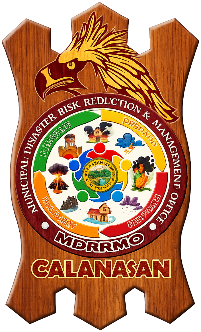
About Our Logo
Identity of protection, readiness, and resilience
The MDRRMO Calanasan Logo symbolizes the office’s mandate to protect lives, properties, and
communities through effective disaster risk reduction and management. The logo reflects the four
thematic areas of DRRM: Mitigation, Preparedness, Response, and Recovery, which serve as the
foundation of all disaster-related programs and services of the office.
The shield-like wooden background represents strength, protection, and readiness in safeguarding the
people of Calanasan. The eagle symbolizes courage, vigilance, and leadership, reflecting the
commitment of the MDRRMO to remain alert and responsive in times of emergencies and disasters.
At the center, the Municipal Seal of Calanasan signifies that all DRRM efforts are anchored on public
service and local governance. Surrounding it are images of hazards such as flooding, landslide, fire,
volcanic eruption, storm, and other emergencies, representing the different risks that the municipality
prepares for and responds to.
The four colored sections represent the disaster management cycle: green for Mitigation, which focuses
on reducing risks; yellow for Preparedness, which emphasizes planning, training, and readiness; red for
Response, which represents immediate action during emergencies; and orange for Recovery, which signifies
rehabilitation, rebuilding, and restoring normalcy after a disaster.
Overall, the logo represents the identity, responsibility, and commitment of the Municipal Disaster Risk
Reduction and Management Office of Calanasan in building a safer, prepared, and disaster-resilient
community.
MDRRMO Calanasan, Apayao
Frontline and internal service standards of the Municipal Disaster Risk Reduction and
Management Office in compliance with RA 11032 and RA 10121.
For emergency incidents, call or report immediately through official MDRRMO channels. For non-emergency service requests,
use the service procedures below.
This expanded Citizen's Charter follows CSC and ARTA service-delivery presentation standards by showing the service title,
documentary requirements, turnaround time, fees, responsible personnel, and the step-by-step client and office actions for every listed service.
🏛 Office Profile
Office
Mayor's Office - Local Disaster Risk Reduction Management Unit
Vision Statement
A progressive and resilient Calanasan is the biodiversity center of the far north.
Mission Statement
Through the vigilant implementation of all municipal programs, the local leaders, together with a locally capable and productive workforce and constituents, shall propel the economic transformation of the locality towards a self-reliant community.
Aim
Resilient communities that are hit by a disaster can bounce back higher; they can cope, readily recover, and adjust easily.
⚖ Legal Bases and Major Functions
Primary Legal Basis
Republic Act No. 10121 and its implementing guidelines for the establishment of Local DRRM Offices and Barangay DRRM Committees.
ARTA / Service Standard Basis
Republic Act No. 11032 or the Ease of Doing Business and Efficient Government Service Delivery Act of 2018.
Core Mandate
Design, program, and coordinate DRRM activities; facilitate risk assessment and contingency planning; maintain local risk information and resource databases; conduct training and public awareness; operate early warning systems; and coordinate response, recovery, and local DRRM implementation.
Emergency Operations
Conduct continuous disaster monitoring, mobilize LGU and partner resources, maintain a DRRM Operations Center, and coordinate emergency response and recovery activities.
Local Governance Role
Serve as the secretariat and executive arm of the LDRRMC, recommend local ordinances, implement approved plans and programs, and submit utilization reports for DRRM funds and resources.
MDRRMC ChairmanShamir Marrero Bulut
Municipal Mayor
Francisco B. Florendo Jr.
LDRRMO III
Administrative Assistance Unit
Shehlamer Paul Cuyen
Process Server
Myla A. Gapic
Messenger
Operations and Warning Section
Noriel Manglugay
LDRRMO I
Research and Planning Section
Normalita Daguio
LDRRMO I
Vacant
Driver - Rescue Vehicle (RV) Charlie
Training and Admin Section
Seowana Karla Danggan
LDRRMO II
Florentino G. Danggan
Driver - Rescue Vehicle (RV) Alpha
24/7 Emergency Operation Center
Glenmar Laguitnay
Team Leader
Edgar Banguel
Driver (RV Bravo)
Abe Daup
Member
Drimar Banguel
Member
Kheysa Danggan
Member
John-Ayke Taccalan
Member
Kenneth Gubing
Member
Mark Vincent Bulsao
Member
ABAna Mae Badarran
Member
🏢 Organizational Structure and Staffing Pattern
Position / Unit
Staffing Pattern
Description / Function
Municipal Mayor / MDRRMC Chairman
Shamir Marrero Bulut
Provides executive oversight, policy direction, and overall leadership of the MDRRMC and local DRRM governance.
LDRRMO III
Francisco B. Florendo Jr.
Heads the Local Disaster Risk Reduction and Management Office and supervises the implementation of DRRM programs, preparedness, coordination, and response operations.
Administrative Assistance Unit
Shehlamer Paul Cuyen - Process Server
Myla A. Gapic - Messenger
Provides receiving, records, routing, logistical support, and day-to-day administrative assistance.
LDRRMO II
Seowana Karla Danggan
Provides technical and operational support to office management and DRRM implementation.
Operations and Warning Section
Noriel Manglugay - LDRRMO I
Edgar Banguel - Driver, Rescue Vehicle Bravo
Operates multi-hazard early warning systems, conducts continuous monitoring, mobilizes resources, and supports emergency response coordination.
Research and Planning Section
Normalita Daguio - LDRRMO I
Vacant - Driver, Rescue Vehicle Charlie
Coordinates DRRM planning, local risk assessment, consolidation of risk information, and maintenance of planning and resource databases.
Training and Admin Section
Seowana Karla Danggan - LDRRMO II
Florentino G. Danggan - Driver, Rescue Vehicle Alpha
Handles training activities, knowledge management, public awareness, service coordination, and related support for preparedness and capability-building work.
24/7 Emergency Operation Center
G. Lennmar Laguitnay - Team Leader
K. Heysa Danggan - Member
D. Rimar Banguel - Member
A. Be Dauo - Member
Serves as a self-sufficient hub for disaster preparedness and coordination during emergencies and disasters. It monitors climate-related hazards and closely coordinates with partner agencies for immediate action and field deployment.
Functional Chart
Municipal Mayor / MDRRMC Chairman
Provides executive direction, inter-office leadership, and overall policy guidance for local disaster risk reduction and management.
LDRRMO III
Leads the LDRRMO and ensures day-to-day implementation, supervision, coordination, and delivery of DRRM services.
Administrative Assistance Unit
Provides receiving, records, routing, logistical support, and day-to-day administrative assistance.
24/7 Emergency Operation Center
Serves as a self-sufficient hub for disaster preparedness and coordination during emergencies and disasters. It monitors climate-related hazards and closely coordinates with partner agencies for immediate action and field deployment.
DRRM Operations and Warning Section
Operates multi-hazard early warning systems, conducts continuous monitoring, mobilizes resources, and supports emergency response coordination.
DRRM Administration and Training Section
Organizes training, knowledge management, public awareness, preparedness activities, and compliance support for DRRM services.
DRRM Research and Planning Section
Coordinates DRRM planning, local risk assessment, consolidation of risk information, and maintenance of planning and resource databases.
🎓 DRRM Training Request
Description
Processing of DRRM training requests in line with MDRRMO capacity-building services and ARTA service standards.
Client
Barangays, schools, offices, and organizations
Requirements
Request letter indicating the training topic, target participants, schedule preference, and contact details.
Processing Time
Based on request evaluation, coordination, and scheduled activity date
Fees
None
Person Responsible
Admin Staff, MDRRMO Head, Training Unit, and Trainers
Step-by-Step Flow
1Submit request letter
➜
2Request is evaluated and scheduled
➜
3Office coordinates with the client
➜
4Attend training and receive certificate
Step
Client Action
Agency Action
Processing Time
Fees
Person Responsible
1
Submit request letter
Receive and log request
5 minutes
None
Admin Staff
2
-
Evaluate request and schedule
1-2 days
None
MDRRMO Head
3
-
Coordinate with client
1 day
None
Training Unit
4
Attend training
Conduct training
As scheduled
None
Trainers
5
Receive certificate
Prepare and release certificate
Same day
None
Admin Staff
📄 Issuance of Certification
Description
Issuance of MDRRMO certification documents following verification and release procedures.
Client
Individuals, offices, and requesting parties
Requirements
Certification request and supporting documents, if applicable.
Processing Time
Within the standard verification and preparation period
Fees
None
Person Responsible
Admin Staff, MDRRMO Staff, and Releasing Officer
Step-by-Step Flow
1Submit request
➜
2Documents are verified
➜
3Certification is prepared
➜
4Claim released document
Step
Client Action
Agency Action
Processing Time
Fees
Person Responsible
1
Submit request
Receive documents
5 minutes
None
Admin Staff
2
-
Verify documents
1 day
None
MDRRMO Staff
3
-
Prepare certification
1 day
None
Admin Staff
4
Claim document
Release certification
5 minutes
None
Releasing Officer
🗺 Hazard Assessment Request
Description
Hazard assessment processing using official hazard references such as HazardHunterPH and GeoRiskPH.
Client
Residents, applicants, planners, and requesting parties
Requirements
Exact location details and any available supporting site information.
Processing Time
Same-day processing for standard requests
Fees
None
Person Responsible
Planning Staff, Planning Officer, Planning Unit, and MDRRMO
Step-by-Step Flow
1Submit location details
➜
2Hazard is analyzed using official tools
➜
3Report is prepared
➜
4Receive released findings
Step
Client Action
Agency Action
Processing Time
Fees
Person Responsible
1
Submit location details
Receive request
5 minutes
None
Planning Staff
2
-
Analyze hazard using HazardHunterPH / GeoRiskPH
Same day
None
Planning Officer
3
-
Prepare report
Same day
None
Planning Unit
4
Receive result
Release findings
5 minutes
None
MDRRMO
🚨 Emergency Response
Description
Immediate emergency response activation for reported incidents requiring MDRRMO action.
Client
General public and affected communities
Requirements
Incident report with location and emergency details through official MDRRMO channels.
Processing Time
Immediate to ongoing, depending on field conditions
Fees
None
Person Responsible
EOC Personnel, Operations Team, Response Team, and MDRRMO
Step-by-Step Flow
1Report incident
➜
2Responders are dispatched
➜
3Rescue or response is conducted
➜
4Assistance is provided
Step
Client Action
Agency Action
Processing Time
Fees
Person Responsible
1
Report incident
Receive call
Immediate
None
EOC Personnel
2
-
Dispatch responders
5-15 minutes
None
Operations Team
3
-
Conduct rescue/response
Ongoing
None
Response Team
4
-
Provide assistance
Ongoing
None
MDRRMO
💬 Feedback and Complaint Mechanism
Feedback Channel
Office visit, official website/portal, mobile phone, radio communication, or written feedback form
Complaint Handling
All complaints shall be acknowledged, recorded, and referred to the appropriate office/personnel for action
Response Time
Within 3 working days for non-emergency service concerns; emergency concerns are acted upon immediately based on nature of report
Responsible Office
MDRRMO Calanasan
Online Feedback Form
Submit feedback to the MDRRMO review sheet through Google Sheets via Apps Script.
📚 Training & Onboarding
📚 Training & Onboarding Center
Calanasan MDRRMO Portal Training and Onboarding
Learn the current portal workflow: public viewing and report submission, MDRRMO officer-only editing, updated emergency hotlines, evacuation center pagination, and Barangay/School DRRM Committee directory management.
Overall Progress0%
0 of 6 tutorials completed
Choose your learning path
Start with the responsibilities you perform
Each path begins with the essential workflow and progresses toward practical portal use.
01
Public Viewer and Reporter
Find trusted information and submit a complete report
Read alerts, hotlines, weather, and hazard information
Locate evacuation and public safety references
Submit incident details without accessing officer controls
02
MDRRMO Duty Officer
Operate protected EOC and documentation tools
Use Duty Officer Login and verify access status
Manage incidents, activities, reports, and public updates
Review accuracy and shared-device visibility before handover
03
Barangay and School DRRM Focal
Maintain coordination and readiness information
Search committee directories and verify contact details
Understand which updates require officer access
Support preparedness, warning, and coordination workflows
Operational readiness check
Before using the portal during an incident
Confirm your role.Viewer, reporter, network focal, or authorized duty officer.
Verify the source and time.Use official timestamps and distinguish live data from saved fallbacks.
Check device visibility.Confirm saved operational records appear on another device when universal access is required.
Record the handover.Review unfinished reports, active incidents, and pending updates before ending duty.
Latest Portal Updates to Learn
Secure Duty Officer LoginUse the centered secure-login panel for protected editing, uploads, incident management, calendar encoding, and official records.Situational Overview ConsolidatedEach hazard now has one authoritative operational card supported by a single verified refresh and assessment workflow.Advisory Reference ArchiveExpired typhoon and hazard advisories are retained by event for planning reference while Latest Alerts remains reserved for active notices.Upgraded EOC Navigation and UtilitiesThe command-console menu, responsive Utilities Control Center, and modal information panels provide clearer access across devices.
🏠
Portal Navigation and Officer Access
Learn where public users can view or submit reports, and where MDRRMO officers log in to unlock editing functions.
Beginner20 min
🌈
Hazard Monitoring and Weather Readiness
Review hazard monitoring, rainfall awareness, fire monitoring, and how official advisories support preparedness decisions.
Intermediate30 min
🚨
Emergency Hotlines and Incident Workflow
Practice using the updated hotline cards, citizen reports, incident log, documentation, and officer-only report management.
Advanced35 min
🔥
Evacuation Centers and Public Safety References
Learn how the encoded evacuation center list, Previous/Next controls, and public safety references are used during advisories.
Learn how officers add activities, edit records, upload documentation, and keep coordination modules current without exposing edit tools to public users.
Advanced40 min
Training Simulation Mode
Practice real-world disaster scenarios in a safe, controlled environment.
🌊 Advanced Flood Response Scenario
Weather Emergency
Simulate coordinated response to severe flooding with real-time rainfall monitoring, automated alerts, multi-source data integration, and advanced evacuation management systems.
Intermediate50 min2-4 participants
🌋 Earthquake Response Scenario
Geological Hazard
Practice earthquake response protocols including damage assessment, search and rescue coordination, and emergency medical response.
Advanced60 min3-6 participants
🌪 Landslide Response Scenario
Geological Hazard
Simulate response to landslide incidents including area evacuation, route assessment, and community safety measures.
Intermediate40 min2-3 participants
🔥 Forest Fire & NASA FIRMS Response
Fire Emergency
Practice advanced wildfire response using NASA FIRMS hotspot detection, real-time satellite monitoring, automated fire spread prediction, and coordinated multi-agency response.
Advanced60 min3-5 participants
📡 Multi-Platform Communication Crisis
Communication Emergency
Practice coordinated crisis communication using SMS gateway, live chat, broadcast messaging, social media integration, and multi-channel public alert systems during complex emergencies.
Intermediate45 min2-4 participants
Simulation Settings
Comprehensive Knowledge Base
🌊
Officer Access and Security
Guides for MDRRMO officer login, protected editing, public-user limits, and safe local testing.
15 articles
🌋
Earthquake Preparedness
Earthquake safety protocols, building assessment, and response coordination.
8 articles
🌪
Landslide Response
Landslide risk assessment, early warning systems, and evacuation procedures.
6 articles
🔥
Forest Fire Monitoring
NASA FIRMS integration, hotspot detection, satellite monitoring, wildfire prediction, and coordinated fire response.
10 articles
📝
Evacuation Center Directory
Encoded evacuation centers, Previous/Next browsing, public activation reminders, and officer correction workflow.
15 articles
📞
DRRM Committee Directories
Barangay and School DRRM Committee records, highlighted encoded details, search, view, edit, and sync procedures.
12 articles
👥
Hotlines, Reports, and Coordination
Updated emergency hotline cards, citizen reports, activity calendar, official communications, and daily officer review.
11 articles
Articles
Frequently Asked Questions
How do I navigate and use the modern PWA features?+
The portal is a Progressive Web App (PWA) with offline capabilities. Use the navigation menu to access sections. Install on mobile devices for app-like experience. The portal works offline with cached data and supports push notifications for critical alerts.
What is the difference between Viewer mode and Officer mode?+
Viewer mode allows public users to read information and submit reports. Officer mode is for MDRRMO personnel and unlocks protected work such as editing, deleting, uploading, calendar activity encoding, syncing records, and report management.
How do I report an emergency incident?+
For immediate emergencies, call the Calanasan Operation Center hotline first: 0997-763-2050. For online reporting, use Citizen Reporting and include location, incident type, severity level, and contact information.
How do rainfall monitoring and flood alerts work?+
The portal uses multi-source rainfall data with automated alert thresholds. Real-time monitoring provides early warnings through SMS, push notifications, and portal alerts. System integrates barangay-level data for precise flood risk assessment and evacuation recommendations.
How does forest fire monitoring with NASA FIRMS work?+
The portal integrates NASA FIRMS satellite data for real-time hotspot detection. Automatic alerts trigger when fire activity is detected near Calanasan. System provides fire spread predictions, evacuation zone mapping, and coordinates with fire response teams for rapid intervention.
Why can't I access certain features of the portal?+
Editing, deleting, uploading, syncing, activity encoding, and report management require officer authentication. If you are an authorized MDRRMO officer, log in through the Duty Officer Login submenu, then refresh with Ctrl + F5 if the page still appears outdated.
Why are some Barangay or School DRRM Committee rows highlighted?+
Highlighted rows have real encoded details such as a name or contact number. Rows without verified details remain plain and usually show For updating, so staff can quickly see which records need follow-up.
How do I browse the evacuation center list?+
Open Emergency Information > Evacuation Centers. Use Previous and Next to move through the encoded evacuation centers. The list is paginated so it does not become too long for public users.
How do modern communication and alert systems work?+
The portal supports multi-platform communication: SMS gateway for text alerts, push notifications for mobile devices, live chat for coordination, broadcast messaging for public alerts, and social media integration. Enable notifications in Utility menu and configure your preferred alert channels.
How do I access training modules and simulations?+
Navigate to the Training & Onboarding section from the main menu. Here you'll find interactive tutorials, simulation exercises, knowledge base articles, and video guides. Start with basic tutorials and progress to advanced simulations as you gain proficiency.
Can I practice emergency scenarios without affecting live operations?+
Yes! The Simulation Mode provides a safe training environment where you can practice various disaster scenarios. All simulation activities are isolated from live operations and don't affect real emergency response systems.
Video Training Guides
Step-by-step video tutorials for critical MDRRMO functions and procedures.
🏥 Modern Portal & PWA Features
▶
Officer Login and Public View
Learn how public access differs from MDRRMO officer access.
10:15Beginner
▶
Current Portal Navigation
Find hotlines, evacuation centers, DRRM Committee directories, utilities, and reports.
14:30Beginner
Emergency Response Procedures
▶
Citizen Reports and Officer Management
Step-by-step guide from public report submission to officer-only follow-up.
15:20Intermediate
▶
Activity Calendar and Documentation
Encode activities, attach documentation, and keep records current in officer mode.
18:45Advanced
▶
Evacuation Center Directory
Use the encoded evacuation centers and Previous/Next controls during advisories.
22:10Advanced
🔥 Hazard Monitoring and Public References
▶
Hazard Monitoring Overview
Use hazard monitoring together with public advisories and field validation.
16:20Intermediate
▶
Public Safety References
Understand how hotlines, advisories, and evacuation references support public safety.
13:45Intermediate
📡 DRRM Committee Coordination
▶
Barangay and School DRRM Committee Records
Review highlighted encoded details, search records, and sync verified updates.
12:45Intermediate
▶
Committee Search and View
Use search, View, highlighted rows, and encoded-detail badges for faster validation.
16:20Intermediate
📞 Communications and Coordination
▶
Official Communications
Upload and manage official memoranda, advisories, letters, and coordination files in officer mode.
13:15Intermediate
▶
End-of-Shift Coordination Review
Review reports, activities, directory updates, uploads, and public advisories before closing duty.
19:40Advanced
Tutorial
Step 1 of 1
Simulation
Time: 00:00Score: 0Phase: Preparation
Video Tutorial
▶ Video Player
Video content would be embedded here
Video Description
Video description and key learning points would be displayed here.
Related Resources:
Knowledge base articles
Practice exercises
Reference materials
Live Situation Summary
Geological Hazard Monitoring
Quick operational snapshot from the hazard viewer, earthquake feed, volcano watch, and forest fire monitoring modules.
Last Updated--
Refreshes when monitoring data or module status changes.
Landslide Monitoring
Landslide Risk Barangays
Choose a landslide susceptibility level to view affected barangays.
No active filter
High0
Moderate0
Low0
No risk level selected.
Southwest Monsoon Situational Awareness
Habagat / Monsoon Rain Monitoring
Animated rain and wind guidance for Northern Luzon, with a color-coded model indicator for possible Habagat enhancement affecting Calanasan and nearby areas.
Habagat indicatorChecking...
Operational note: This feature combines forecast-model wind, moisture, and rainfall indicators. It does not independently declare that Habagat is active or replace DOST-PAGASA forecasts, rainfall warnings, or official advisories.
Animated Habagat Guidance MapOpen this feature to load the animated rainfall layer.
Use the timeline and play controls inside the map to animate forecast rainfall. Switch to Wind Flow to inspect the southwest-to-northeast moisture-bearing flow associated with Habagat.
Green — WeakLimited southwest flow or rainfall signal
Forecast fallback data: Open-Meteo,
licensed under CC BY 4.0.
Model estimates are identified as estimates and do not replace PAGASA warnings.
🌍 Earthquake Monitoring
🌍 Latest Earthquake Updates (Auto Monitoring)
The list below shows the most recent recorded earthquakes based on the PHIVOLCS latest earthquake information feed.
PHIVOLCS remains the official national authority for Philippine earthquake bulletins.
Snapshot-style volcano situational awareness for active and inactive Philippine volcanoes.
Official eruption notices and alert levels must still be verified with PHIVOLCS before public release.
Connecting to current official PHIVOLCS-LAVA bulletins. Alert levels remain withheld until live verification succeeds.
Highest AlertChecking...
Active Volcanoes-
Inactive / Potentially Active-
Snapshot Checked-
Checking official PHIVOLCS volcano bulletin status...
Source basis: local portal snapshot derived from PHIVOLCS volcano alert-level references and PHIVOLCS-LAVA bulletin links. This module is not a live PHIVOLCS API feed and must not replace official PHIVOLCS bulletins.
Forest Fire / Hotspot Monitoring
Forest Fire / Hotspot Monitoring
Real-time monitoring of NASA FIRMS fire hotspots inside Calanasan only and up to 15 km beyond municipal borders.
Data provides thermal anomaly detection for early warning of potential forest and vegetation fires.
Hotspots (24h)-
Nearest Border-
StatusLoading...
Updated-
Live Fire Hotspot Map
High Confidence
Medium Confidence
Low Confidence
Calanasan
Boundary Layer
Barangay GeoJSON Map
Reported Smoke
Detected Hotspots
Loading fire hotspot data...
Incident / Spot Reports
Forest fire spot reports will appear here.
Officer-issued reports and updates for Calanasan forest fire incidents.
No forest fire spot report has been published yet.
Officer Forest Fire Spot Report Editor
📸 2. Situation Overview Photos (Max 15 images)
0/15 photos uploaded
Uploaded photos are attached to the incident / spot report and shown with the situation overview.
Disclaimer: Satellite-detected hotspots are subject to ground validation and are not automatically confirmed forest fires.
False positives can occur due to industrial heat sources, solar reflections, or other thermal anomalies.
Data Source: NASA FIRMS (Fire Information for Resource Management System) - VIIRS SNPP Near Real-Time
Useful for fast developing disasters, rescue operations, and traffic disruptions.
GMA News Watch
Live keyword scan for floods, landslides, earthquakes, typhoons, fires, accidents, and evacuations.
No disaster-related headlines detected in the latest scan.
Scanned Apr 10, 2026, 1:13 AM with no disaster keyword matchOpen Source
ABS-CBN News Watch
Monitors ABS-CBN News text for ongoing incidents, severe weather, and emergency response coverage.
[#### Wreckage of missing Cessna plane found in Dinagat Islands](http://news.abs-cbn.com/news/regions/2026/4/9/wreckage-of-missing-cessna-plane-found-in-dinagat-islands-passengers-still-missing-1629)
[### Wreckage of missing Cessna plane found in Dinagat Islands](http://news.abs-cbn.com/news/regions/2026/4/9/wreckage-of-missing-cessna-plane-found-in-dinagat-islands-passengers-still-missing-1629)
Live scan updated Apr 10, 2026, 1:13 AMOpen Source
News5 Watch
Adds another TV-network source for incident monitoring, road disruptions, and major public safety updates.
No disaster-related headlines detected in the latest scan.
Source check failed at Apr 10, 2026, 1:13 AMOpen Source
Inquirer Watch
Online newspaper scan for national disaster, infrastructure, transport, and casualty-related reports.
### [‘Clear, deliberate act of bullying’: China fires flares at PCG plane over Panganiban, Zamora reefs](https://www.rappler.com/philippines/china-fire-flares-coast-guard-plane-panganiban-zamora-reef/)
Live scan updated Apr 10, 2026, 1:13 AMOpen Source
OCD Watch
Official Office of Civil Defense monitoring for advisories, preparedness actions, and national response coordination updates.
No disaster-related headlines detected in the latest scan.
Scanned Apr 10, 2026, 1:13 AM with no disaster keyword matchOpen Source
PNA Government Wire Watch
Official government newswire scan for national disaster, response, evacuation, and transport disruption reporting.
No disaster-related headlines detected in the latest scan.
Scanned Apr 10, 2026, 1:13 AM with no disaster keyword matchOpen Source
PIA Disaster Watch
Government information monitoring for disaster information service posts, local incident reporting, and response bulletins.
Title: Disaster Information Service - Philippine Information Agency
Live scan updated Apr 10, 2026, 1:13 AMOpen Source
🏛 DRRM Agency Tools
Official DRRM Agency Tools
Access official government tools for weather, warnings, earthquake monitoring,
hazard maps, and site-specific hazard assessment. These remain separate official
systems, so this portal provides a clean launch layer instead of a fragile full embed.
🌦 PAGASA Daily Forecast
Official daily weather forecast and national weather outlook.










 Francisco B. Florendo Jr.
LDRRMO III
Francisco B. Florendo Jr.
LDRRMO III
 Shehlamer Paul Cuyen
Process Server
Shehlamer Paul Cuyen
Process Server
 Myla A. Gapic
Messenger
Myla A. Gapic
Messenger
 Noriel Manglugay
LDRRMO I
Noriel Manglugay
LDRRMO I
 Normalita Daguio
LDRRMO I
Normalita Daguio
LDRRMO I
 Seowana Karla Danggan
LDRRMO II
Seowana Karla Danggan
LDRRMO II
 Florentino G. Danggan
Driver - Rescue Vehicle (RV) Alpha
Florentino G. Danggan
Driver - Rescue Vehicle (RV) Alpha
 Glenmar Laguitnay
Team Leader
Glenmar Laguitnay
Team Leader
 Edgar Banguel
Driver (RV Bravo)
Edgar Banguel
Driver (RV Bravo)
 Abe Daup
Member
Abe Daup
Member
 Drimar Banguel
Member
Drimar Banguel
Member
 Kheysa Danggan
Member
Kheysa Danggan
Member
 John-Ayke Taccalan
Member
John-Ayke Taccalan
Member
 Kenneth Gubing
Member
Kenneth Gubing
Member
 Mark Vincent Bulsao
Member
Mark Vincent Bulsao
Member